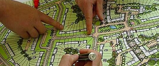
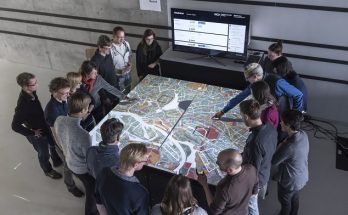
Remote sensing technology has revolutionized the field of planning, offering advanced tools for monitoring, analyzing, and managing land, resources, and infrastructure. By capturing data from satellites, drones, and aircraft, remote sensing provides invaluable insights that enhance decision-making processes in urban planning, environmental management, agriculture, disaster response, and more. The latest advancements in remote sensing have further expanded its applications and improved its accuracy, making it an indispensable tool in modern planning.
1. Introduction to Remote Sensing
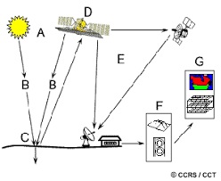
Remote sensing involves the acquisition of information about the Earth’s surface without direct contact. This is achieved through sensors mounted on satellites, drones, and aircraft that detect and measure reflected or emitted electromagnetic radiation. The data collected is then processed and analyzed to generate detailed images and maps, which can be used for various planning purposes.
2. Key Applications of Remote Sensing in Planning
A. Urban Planning and Development
- Land Use and Land Cover Mapping: Remote sensing provides detailed maps that help planners understand current land use patterns and identify areas for development or conservation.
- Urban Growth Monitoring: Time-series data from remote sensing can track urban expansion, enabling planners to manage growth sustainably.
- Infrastructure Planning: High-resolution images assist in the design and management of transportation networks, utilities, and public facilities.
B. Environmental Management
- Climate Change Monitoring: Remote sensing data is crucial for tracking changes in climate variables such as temperature, precipitation, and sea level.
- Biodiversity Conservation: Identifying and monitoring critical habitats and endangered species is made easier with satellite imagery.
- Pollution Control: Detecting and measuring pollution levels in air and water bodies helps in environmental regulation and protection.
C. Agricultural Planning
- Crop Monitoring and Management: Remote sensing provides real-time data on crop health, soil moisture, and nutrient levels, optimizing agricultural practices.
- Drought and Flood Assessment: Early detection of drought and flood conditions allows for timely intervention and mitigation measures.
- Yield Prediction: Analyzing vegetation indices and other parameters aids in forecasting crop yields and planning agricultural activities.
D. Disaster Response and Management
- Disaster Mapping: Remote sensing is essential for mapping areas affected by natural disasters such as earthquakes, hurricanes, and wildfires.
- Damage Assessment: Rapid assessment of damage extent helps in efficient allocation of resources and planning recovery efforts.
- Early Warning Systems: Real-time monitoring of natural hazards provides early warnings and facilitates proactive disaster management.
3. Latest Updates in Remote Sensing Technology
A. High-Resolution Imaging
- Advancements in Sensor Technology: Modern sensors capture images with unprecedented resolution, providing detailed information on small-scale features.
- Improved Spatial and Temporal Resolution: Enhanced resolution allows for more precise monitoring and analysis over shorter time intervals.
B. Integration with AI and Machine Learning
- Automated Image Analysis: AI and machine learning algorithms process vast amounts of remote sensing data, identifying patterns and anomalies with high accuracy.
- Predictive Modeling: These technologies enhance predictive modeling capabilities, improving the accuracy of forecasts and planning scenarios.
C. Hyperspectral and Multispectral Imaging
- Detailed Spectral Analysis: Hyperspectral sensors capture data across a wide range of wavelengths, providing detailed information on material composition and properties.
- Application in Various Fields: This technology is used in agriculture for crop analysis, in geology for mineral exploration, and in environmental monitoring for detecting pollutants.
D. Unmanned Aerial Vehicles (UAVs)
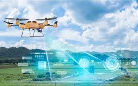
- Drones for Data Collection: UAVs provide flexible, high-resolution data collection capabilities, especially in areas that are difficult to access.
- Cost-Effective Solutions: Drones offer a cost-effective alternative to traditional aerial surveys, with rapid deployment and real-time data acquisition.
4. Challenges and Future Directions
A. Data Management and Processing
- Big Data Challenges: The sheer volume of data generated by remote sensing requires advanced storage, processing, and analysis capabilities.
- Interoperability: Ensuring that data from different sources and sensors can be integrated and used effectively is a significant challenge.
B. Accuracy and Calibration
- Sensor Calibration: Maintaining the accuracy of sensors over time requires regular calibration and validation.
- Ground Truthing: Field data collection is necessary to validate and calibrate remote sensing data, ensuring its accuracy.
C. Policy and Ethical Considerations
- Privacy Concerns: The widespread use of remote sensing raises concerns about privacy and data security.
- Regulatory Frameworks: Developing policies and regulations that govern the use of remote sensing data is crucial for addressing these concerns.
5. Conclusion
Remote sensing has become a cornerstone of modern planning, providing detailed, real-time data that supports informed decision-making across various sectors. The latest advancements in technology, including high-resolution imaging, AI integration, hyperspectral imaging, and UAVs, have further enhanced its capabilities and applications. Despite challenges related to data management, accuracy, and ethical considerations, the future of remote sensing in planning looks promising, with continued innovations poised to drive even greater improvements in the field.
