In this post, you will learn the following:
- The Importance of cartography
- Advantages And disadvantages of cartography
- Research Method in cartography
- Latest Update Of cartography
1. Cartography?
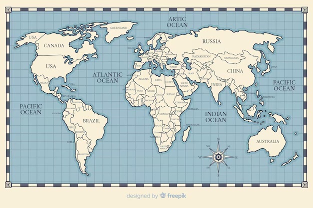
Cartography is the science, art, and technology of making maps. It involves the creation, study, and interpretation of visual representations of geographic spaces, using various methods to convey spatial information. Cartography combines elements of geography, design, and data analysis to produce maps that are accurate, useful, and aesthetically pleasing.
2. The Importance of Cartography
Cartography is crucial for numerous reasons:
- Navigation and Travel: Maps are essential for navigating unfamiliar areas, whether on land, sea, or air. They guide travelers and help in route planning.
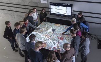
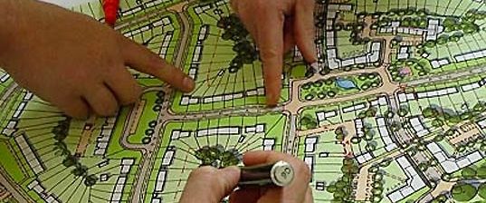
- Urban Planning: City planners use maps to design infrastructure, manage land use, and plan for future development.
- Disaster Management: Maps assist in preparing for and responding to natural disasters by identifying vulnerable areas and planning evacuation routes.
- Environmental Management: Cartographers help monitor and manage natural resources, track environmental changes, and support conservation efforts.
- Education and Research: Maps are tools for teaching geography, history, and other disciplines, providing spatial context and supporting research with visual data.
3. Advantages of Cartography
- Enhanced Understanding: Maps provide a visual representation of spatial relationships and geographical features, making complex information more accessible and understandable.
- Efficient Communication: They effectively communicate information about locations, routes, and geographic phenomena to a wide audience.
- Decision-Making: Maps support informed decision-making in areas such as urban planning, environmental management, and emergency response.
- Customization: Modern cartography allows for the creation of customized maps tailored to specific needs, such as thematic maps focusing on demographic, economic, or environmental data.
4. Disadvantages of Cartography
- Distortion: All maps involve some degree of distortion due to the challenge of representing a three-dimensional Earth on a two-dimensional surface.
- Complexity: Creating accurate and detailed maps can be complex and requires specialized knowledge and technology.
- Resource-Intensive: Advanced cartographic methods and technologies, such as GIS (Geographic Information Systems) and remote sensing, can be expensive and resource-intensive.
- Misinterpretation: Poorly designed or outdated maps can lead to misinterpretation or incorrect conclusions, affecting decision-making and navigation.
5. Research Methods in Cartography
Cartographic research involves several methods and techniques:
- Geospatial Data Collection: Gathering data from various sources, including satellite imagery, aerial surveys, GPS, and field observations. This data forms the basis for map creation and analysis.
- Geographic Information Systems (GIS): A technology used to store, analyze, and visualize spatial data. GIS combines cartographic, statistical, and database techniques to create detailed and interactive maps.
- Remote Sensing: Using satellite or airborne sensors to collect data about Earth’s surface. This method provides valuable information for mapping land cover, urban development, and environmental changes.
- Cartographic Design: Involves the aesthetic and functional aspects of map creation, including map layout, color schemes, symbols, and typography. Good design enhances readability and usability.
- Thematic Mapping: Focuses on specific themes or subjects, such as population density, climate patterns, or economic activities. These maps are used for analyzing and presenting spatial patterns related to particular topics.
- Spatial Analysis: Involves examining and interpreting spatial data to identify patterns, relationships, and trends. Techniques include overlay analysis, buffering, and network analysis.
6. Latest Updates in Cartography
- Integration of AI and Machine Learning: Modern cartography increasingly employs artificial intelligence (AI) and machine learning to automate map production, improve accuracy, and analyze large datasets.
- Interactive and Web-Based Maps: The rise of web mapping platforms and interactive maps allows users to explore spatial data dynamically and in real-time, offering enhanced user experiences.
- Crowdsourced Data: The use of crowdsourced data from platforms like OpenStreetMap has become more prevalent, providing updated and detailed geographic information contributed by volunteers.
- Enhanced Remote Sensing Technologies: Advances in satellite technology and remote sensing have improved the quality and resolution of spatial data, supporting more detailed and accurate mapping.
In summary, cartography is a vital field that bridges science, art, and technology to provide valuable spatial insights. Its applications span numerous sectors, offering significant advantages while also facing challenges related to data accuracy and resource requirements. With ongoing advancements in technology and methods, cartography continues to evolve, enhancing our understanding and management of the world.